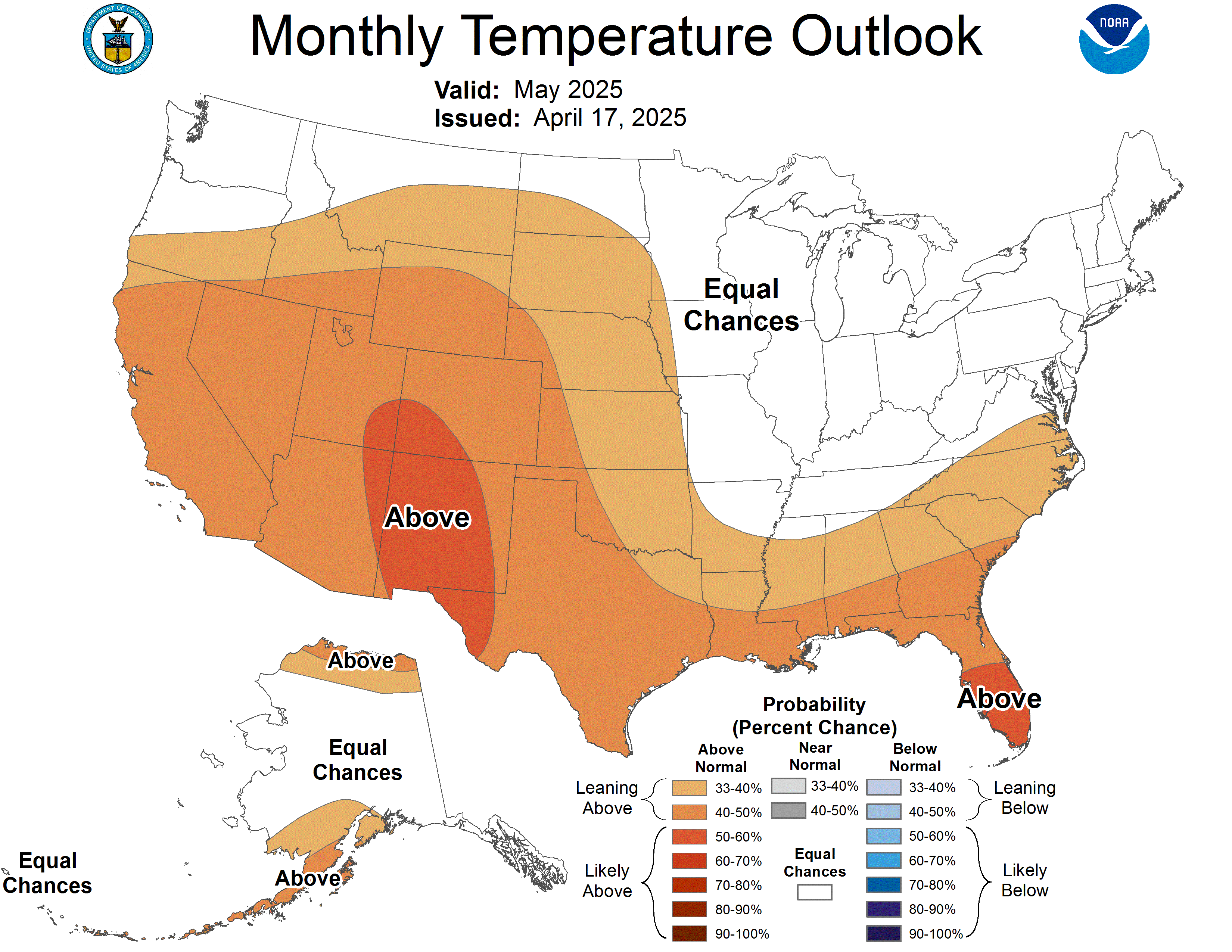
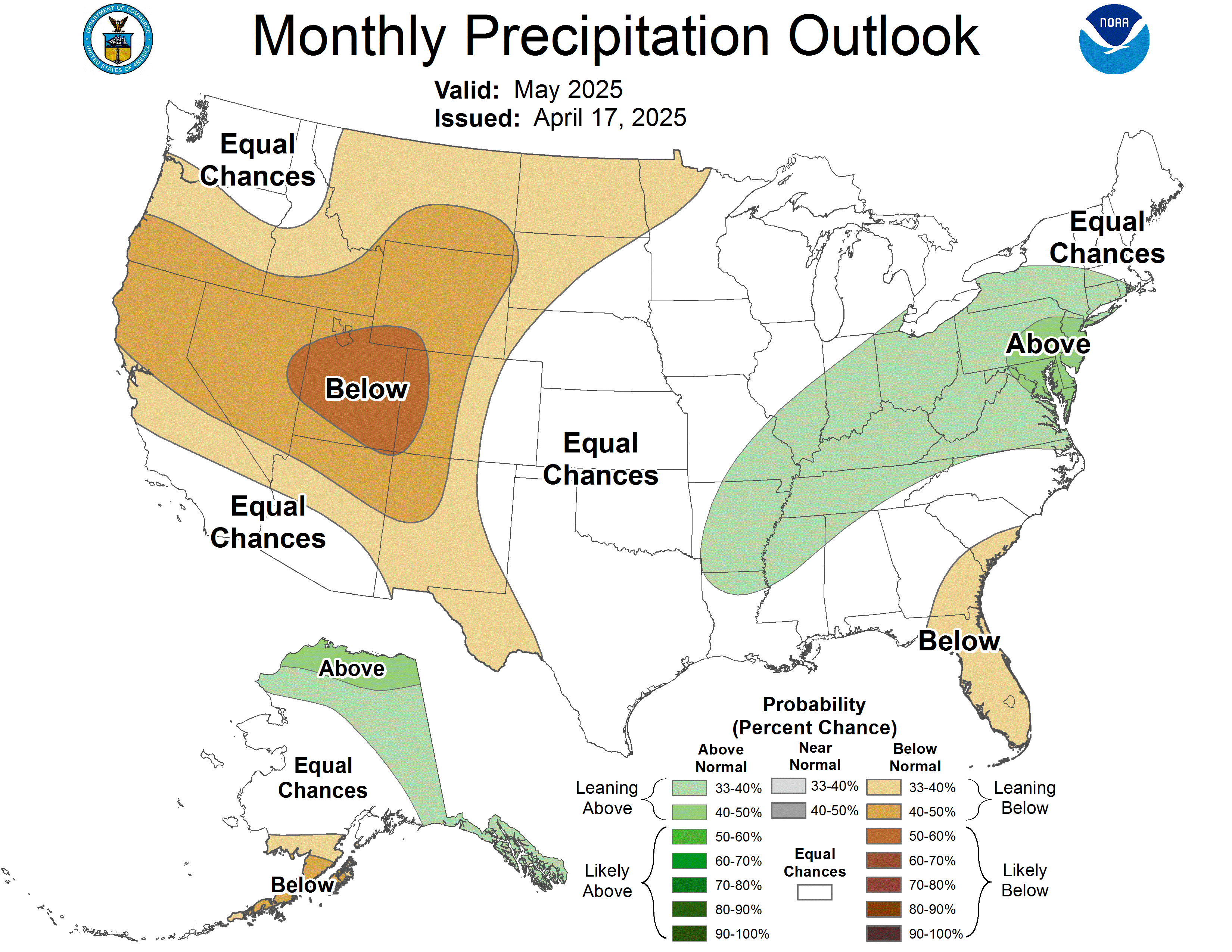
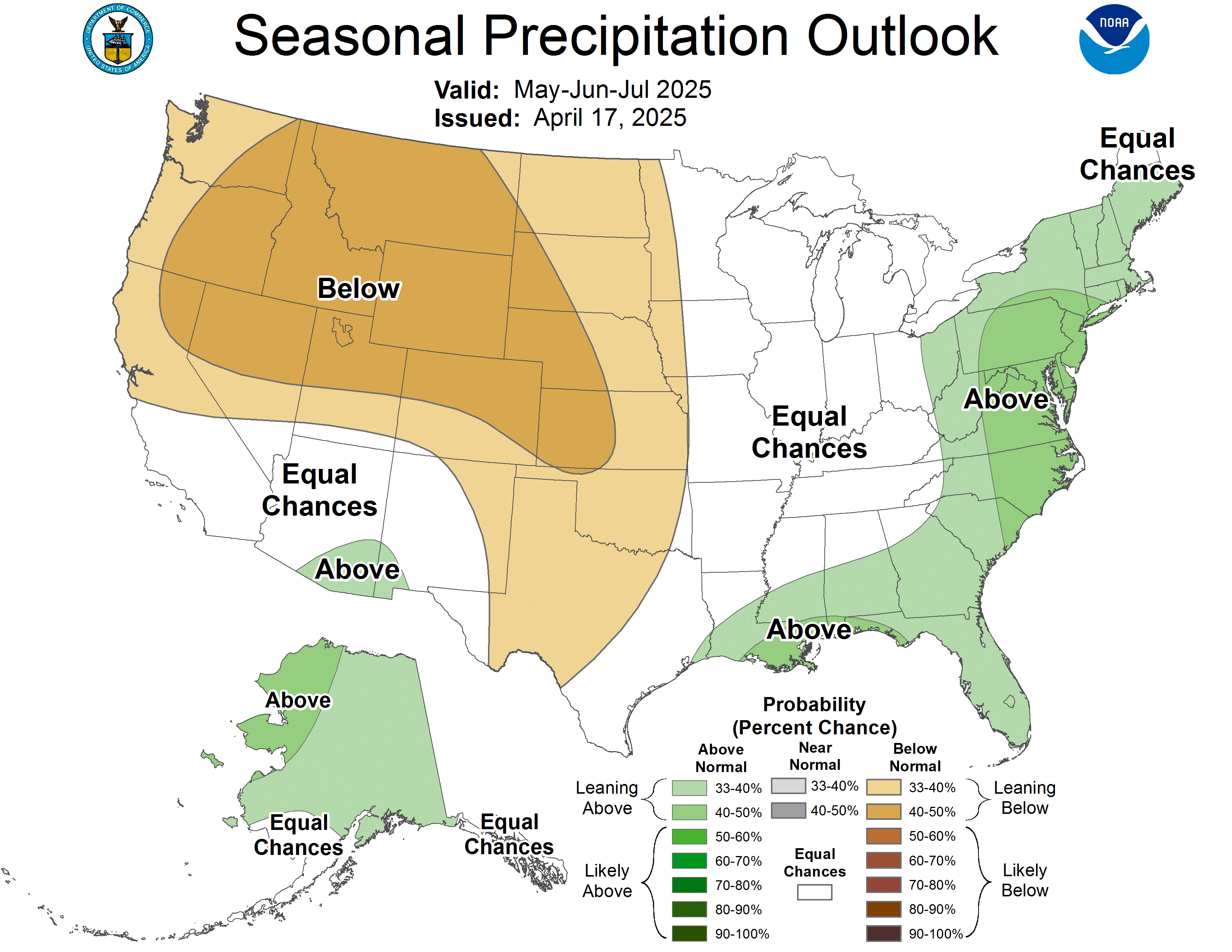
How to read these. The colors show the odds of leaning above or below the 30-year normal, not an exact amount.
For temperature, orange/red leans warmer than normal and
blue leans colder.
For precipitation, green leans wetter (more chances for snow) and
brown leans drier.
White areas mean equal chances either way. These are national maps, so the same outlook covers every resort.
Next 6 to 10 Days
The closest long-range signal. Reissued every afternoon.
TemperatureSource: NOAA CPC ↗

Map temporarily unavailable. View on NOAA
PrecipitationSource: NOAA CPC ↗

Map temporarily unavailable. View on NOAA
Next 8 to 14 Days
Roughly the second week out. Reissued every afternoon.
TemperatureSource: NOAA CPC ↗

Map temporarily unavailable. View on NOAA
PrecipitationSource: NOAA CPC ↗

Map temporarily unavailable. View on NOAA
8 to 14 Day Snow Hazards
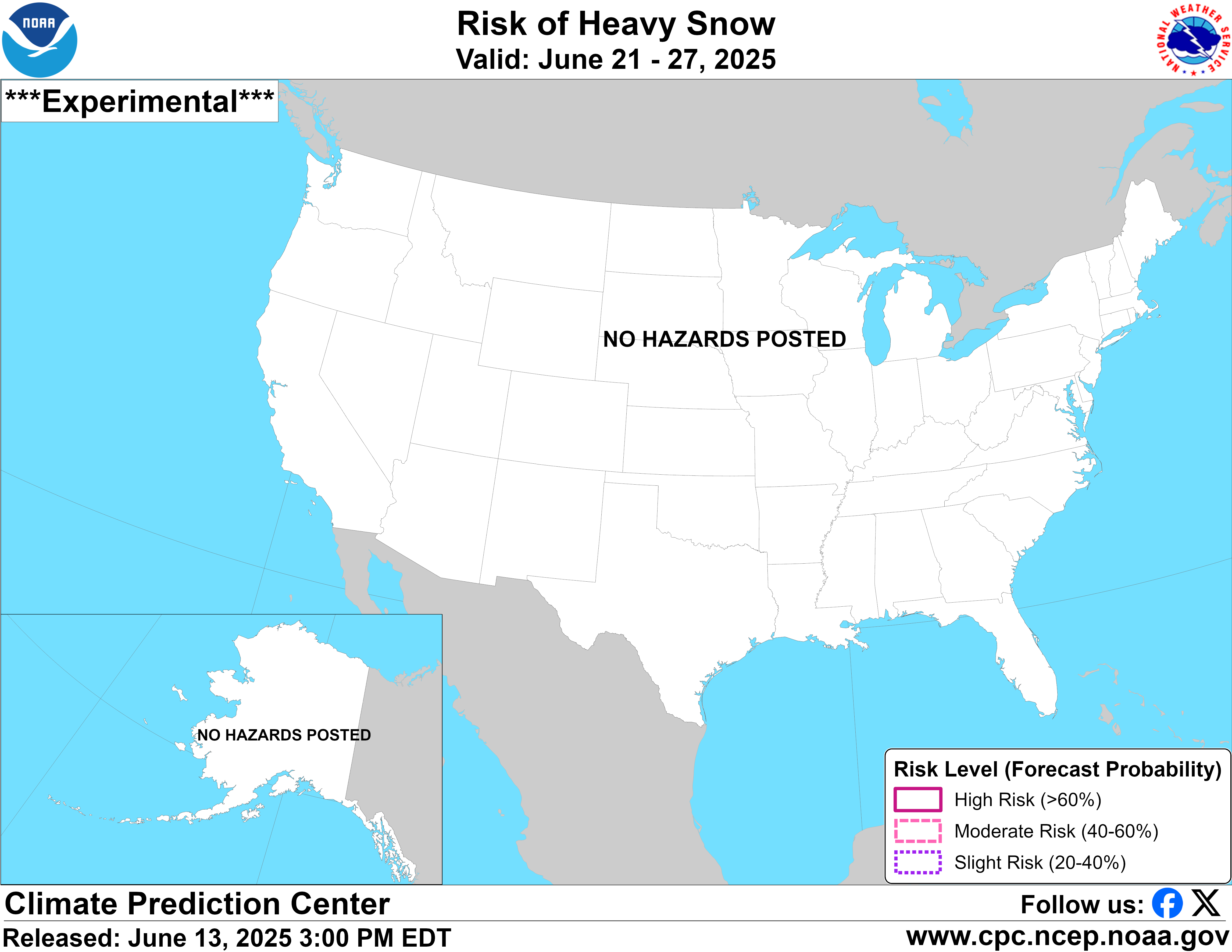
The one map built for exactly what we care about: where NOAA sees a real chance of heavy snow in the second week out.
Probabilistic Snow HazardsSource: NOAA CPC ↗
Map temporarily unavailable. View on NOAA
Shaded areas flag an elevated chance of heavy snow. Blank most of the year, and worth watching when it lights up over the mountains.
Month Ahead
The next 30 days. Updated around mid-month and again at month-end.
TemperatureSource: NOAA CPC ↗
Map temporarily unavailable. View on NOAA
PrecipitationSource: NOAA CPC ↗
Map temporarily unavailable. View on NOAA
Season Ahead (3 Months)
The big-picture pattern for the next three months. Updated monthly.
TemperatureSource: NOAA CPC ↗

Map temporarily unavailable. View on NOAA
PrecipitationSource: NOAA CPC ↗
Map temporarily unavailable. View on NOAA
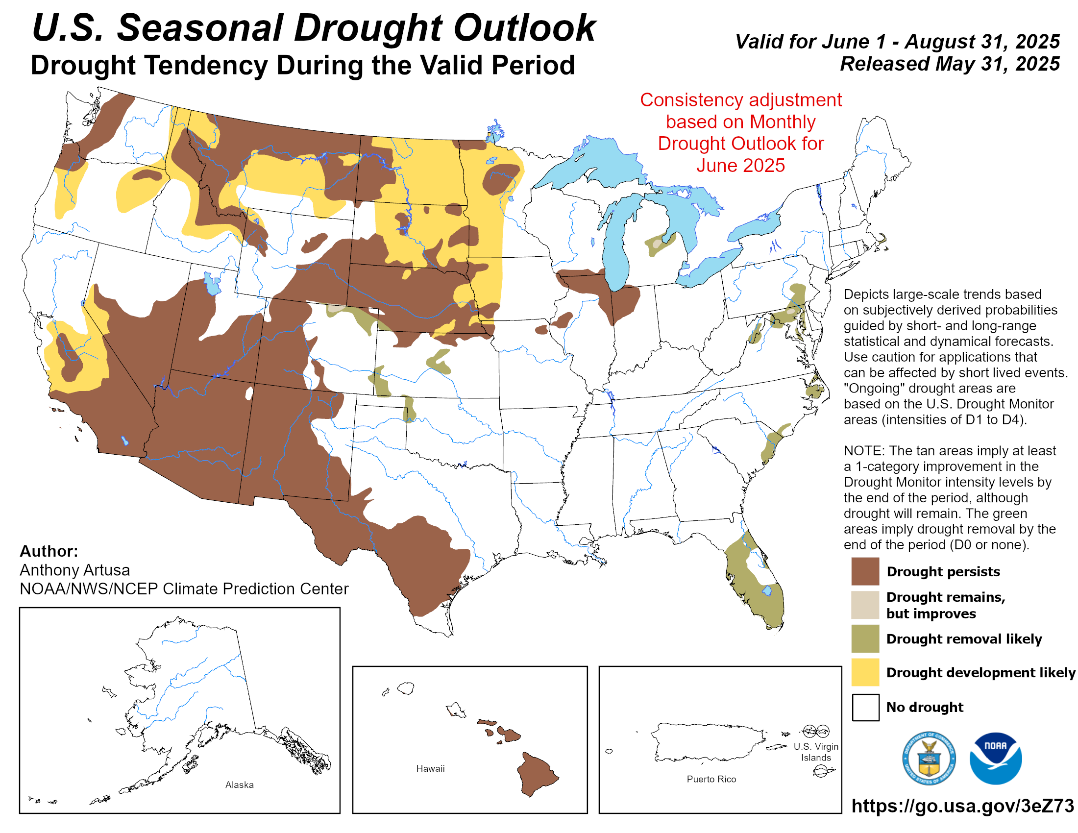
Seasonal Drought Outlook
Drought and snowpack are the same story out West. Where the season is starting from.
Seasonal Drought OutlookSource: NOAA CPC ↗
Map temporarily unavailable. View on NOAA
Where drought is forecast to develop, persist, or ease. A dry setup out West usually means the snowpack has ground to make up.
All maps are issued by NOAA's Climate Prediction Center and update automatically here. Outlooks show probabilities, not guarantees: a "leaning wetter" signal tilts the odds, it does not promise snow on any given day. For the day-to-day forecast at your hill, head to any resort page.